Marine geophysical mapping
High resolution geophysical equipment (sonars)
- 24 kHz Single beam Sub-bottom profiler (pinger), Portable
- 2–9 kHz Sub-bottom profiler (pinger), Dual transducers
-
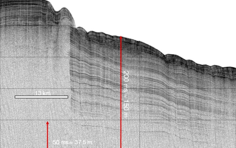
Edgetech SB-0512 Sub-bottom profiler
Portable (on pallet, 204 kg)
Frequency Range: 500 Hz–12 kHz
Vertical Resolution (depends on pulse selected) 8–20 cm
Penetration (typical) in clay: 200 m
Weight in Water: 68 kg
www.edgetech.com
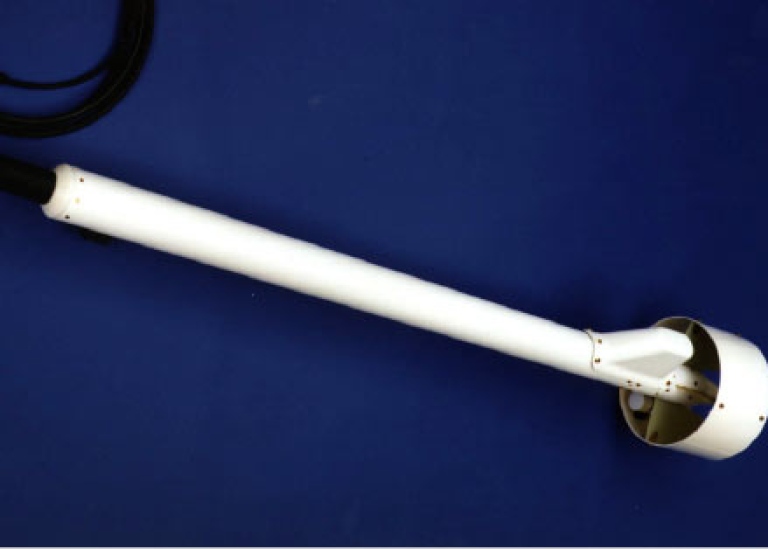
- Edgetech SB-216 Sub-bottom profiler
Portable (76 kg)
Frequency Range: 2–16 kHz
Vertical Resolution (depends on pulse selected): 6–10 cm
Penetration (typical) in clay: 80 metersWeight in Water: 32 kg
www.edgetech.com
- Kongsberg EA600 Single Beam Echo sounder, Hull-mounted on R/V Skidbladne
-
Kongsberg EM122 (1x1°) – Multibeam sonar
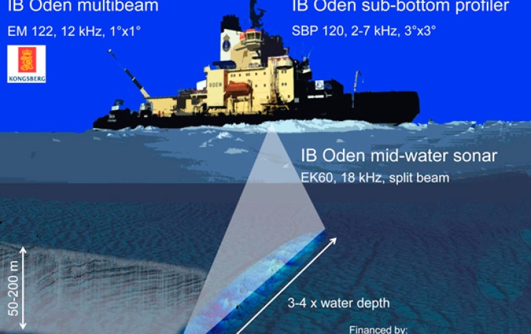
Hull-mounted on Icebreaker Oden
Depth range: 20 to 11000 m
Frequency: 12 kHz (chirp mode and dual swath capability)
Swath width: 4–5 times the water depth
Beam width: 150°x1°
Beams: 288 beams covering a sector up to 150°
www.km.kongsberg.com
-
Kongsberg EM2040 (1°) – Multibeam sonar
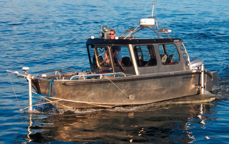 R/V Skidbladner in mapping action with both the bow-mounted EM2040 (200-400 kHz) and side-mounted EA600 (15 kHz) sub-bottom profiler in the water.
Mounted on R/V Skidbladner, but is portable
Depth range: 0.5 to 600 m
Frequency: 200–400 kHz
Swath width: max 750 m
Beam width: 140° x 0.7°
Note: well suited for surveys meeting the IHO-S44 special order requirements.
www.km.kongsberg.com
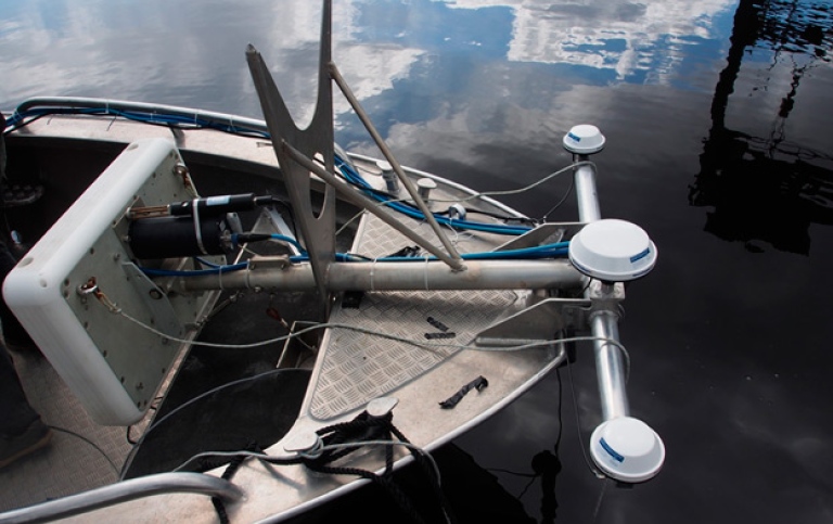
Bow mount of EM2040 on R/V Skidbladner. The GPS on photo are two Hemisphere A101 for heading and one center-mounted Hemisphere R320 (RTK GPS/Glonass) for positioning. In 2015 the positioning system was upgraded to a Seapath 320+. An MRU5+ is mounted on the transducer casing in a subsea bottle.
-
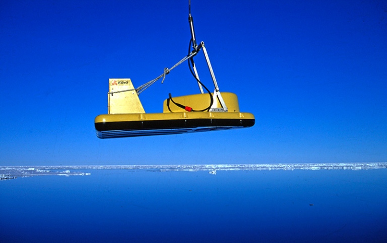
Kongsberg SBP120 (3°) – Chirp sonar (sub-bottom profiler)
Hull-mounted on Icebreaker Oden
Depth range: 20 to 11000 m
Frequency range: 3–7 kHz, chirp
Vertical resolution: 0.35 ms
Horizontal resolution: 3°x3°
Integrated with EM120 by using the same receiving transducer array
www.km.kongsberg.com
- L-3 Klein 3000 Digital Side Scan Sonar
Portable
Depth Range: 600/150 m (operating depth down to 1500 m)
Frequency: 100/500 kHz
Swath width: max 750 m
Beam width: 0.7°/0.21°
- Oden Multibeam and Chirp Sonar System
Please see information about Oden Multibeam and Chirp Sonar System under Marine platforms page.
-
SIMRAD EK60 – Scientific echo sounder for water column data/fish tracking
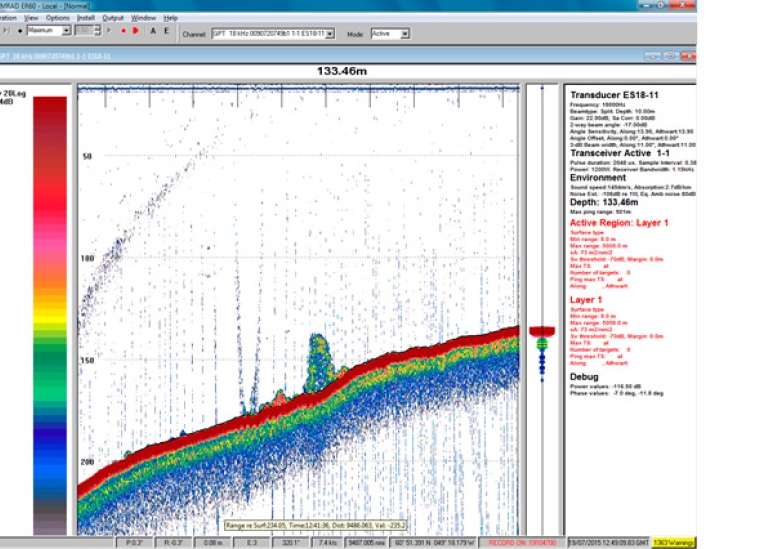 Screen capture showing gas seeps from continental slope off western Greenland. Disturbances are from additional echo sounder.
Installed on icebreaker Oden
Frequency: 18 kHz (possible additional frequencies 18-710 kHz)
Beam width: 20x7° (140°)
Depth range: Full ocean depth
www.simrad.com -
Seapath 320 GPS/GLONASS including MRU5
Installed on Icebreaker Oden
Heading accuracy: 0.05 RMS (4 m baseline)
Roll and pitch accuracy: 0.03 RMS for ±5° amplitude.
Heave accuracy: 5 cm or 5% whichever is highest
Positioning accuracy: (best case) 0.15 m RMS or 0.4 m (95% CEP)
www.km.kongsberg.com
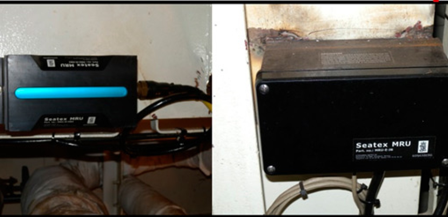
 MRU5+ plus installed in a subsea bottle mounted on the top side of the EM2040 transducer casing. The EM2040 bow-mounted system on R/V Skidbladner is here shown in transport mode, hoisted up on deck. In 2015, the positioning system was changed to the Seapath 330+ including new GPS/GLONASS antennas shown in the photo below. The subsea bottle was also changed to a newer version. The antenna separation has been increased from 1.5 to 2 m.
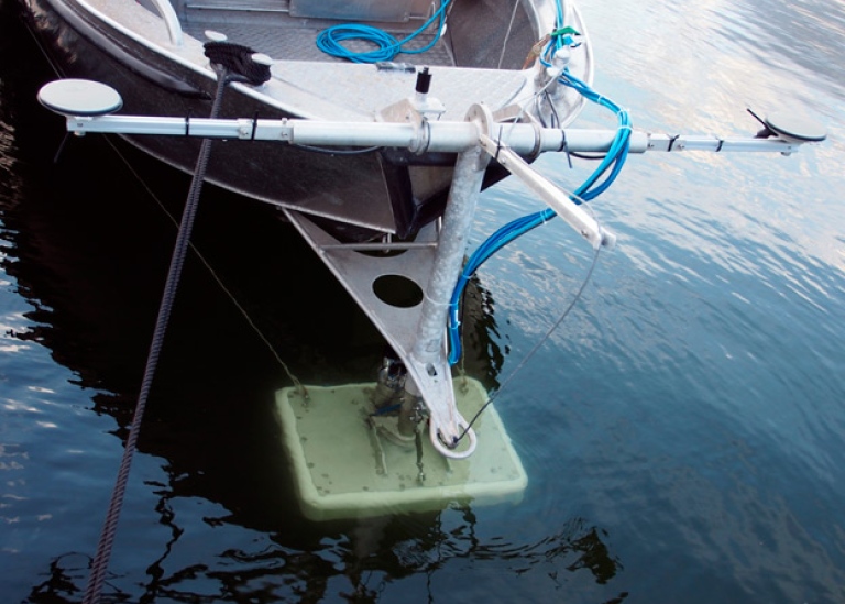 MRU5+ plus installed in a subsea bottle mounted on the top side of the EM2040 transducer casing. The EM2040 bow-mounted system on R/V Skidbladner is here shown in transport mode, hoisted up on deck. In 2015, the positioning system was changed to the Seapath 330+ including new GPS/GLONASS antennas shown in the photo below. The subsea bottle was also changed to a newer version. The antenna separation has been increased from 1.5 to 2 m.
Single-channel seismic equipment
- 2 Bauer Air compressors, Portable (on pallets)
- 2 Bolt Pneumatic Air Release (PAR) airgun, Portable 1500 cubic inches with amplifier
- 2x20 m Hydrophone streamer, Portable (on pallets)100 hydrophone elements each
- 3 Reavell Compair Air compressors, Portable (on pallets)
- Bolt 600 Pneumatic Air Release (PAR) airgun
Portable
1–40 cubic inches with amplifier
Frequency range: 20–500 Hz
Towing depth: 1 to 2 meters
Pulse duration: 10 msec typical - Digital recording units, Portable
Other geophysical equipment
- Geometrics G-880 marine magnetometer
Portable
Measured Quantity: Total Magnetic field in nT at 1sec sample interval
Operating Principle: Self Oscillating split beam Optically pumped Caesium Vapor cell (non-radioactive)
Heading Error: < +/- 0.5nT over entire 360° range
Absolute Accuracy: ±2nT throughout range
Operating Range: 20,000nT to 100,000nT
Pressure Rating: 2000 psi (approx 1300 metres)
Operating Zones: The earth’s field vector should be > 6° away from the sensor’s equator and > 6° away from the sensor’s long axis. Automatic hemisphere switching.
www.oceanscan.net
Last updated: May 13, 2024
Source: Institutionen för geologiska vetenskaper