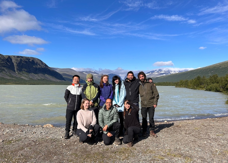
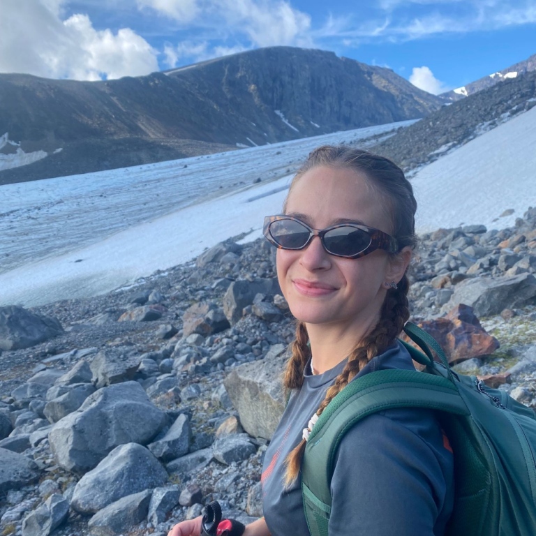
PhD students in Physical Geography on a field visit to Tarfala Research Station
Between the 31st of July and the 5th of August 2023, the mandatory PhD course “Frontiers in Physical Geography” organized a field visit to Tarfala Research Station (TRS). The field visit took the participants through different biomes in the arctic, starting from arctic birch forests around the village of Nikkaluokta to the glaciers of the Tarfala valley at the foot of Kebnekaise, Sweden’s highest mountain.
Hands-on experience of monitoring
Frontiers in Physical Geography is one of two mandatory PhD courses at the Department of Physical Geography at Stockholm University. This year, the course had 15 participants, 9 of which participated in the third and last module of the course consisting of a field visit. The aim of the field visit is to give the PhD candidates a hands-on experience of how the environment is actively monitored and measured, illustrated by the case of Stockholm University’s research station at Tarfala.
We started the trip from Stockholm on the night train to Kiruna on the evening of Monday the 31st of July. We woke up around the artic circle as the train made its way through spruce and pine forests, wetlands, and surface water bodies. We noted the differences in land cover, the density of the forest stands, the sizes of the trees, much smaller than in the south, and the prevalence of water courses often of large dimensions. Land management was also different, with large forest clearcuts, and the unmistakable tailings of the Kiruna mine where both iron and rare earth metals are extracted. The underground mining has forced the relocation of the city of Kiruna, a subject we got to discuss further at the TRS.
This opportunity offers a highly valuable insight of the geophysical processes occurring in the arctic, says Martin
Martin, one of the PhD students, about the field experience:
It was a great new experience for me. At the beginning I was a bit scared and worried about getting there, but fortunately I was able to do it with the support of the group. If I get the opportunity to to do it again, I would definitely do it... besides the incredible landscape, this opportunity offers a highly valuable insight of the geophysical processes occurring in the arctic.
High altitude hike with a warm welcome at TRS
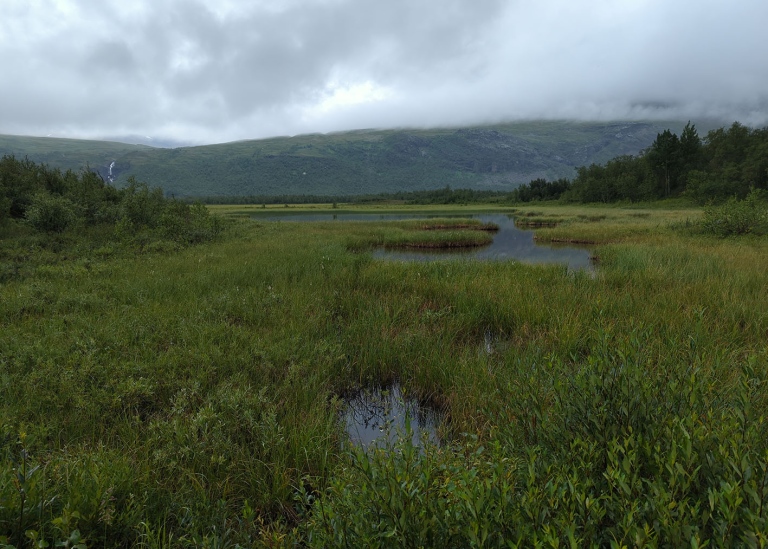
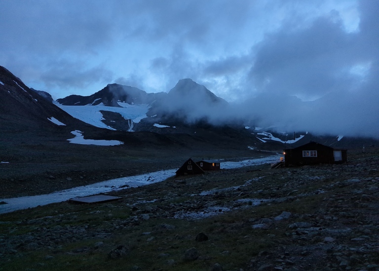
We made our way by buss from Kiruna to Nikkaluokta, where the road ends. From Nikkaluokta, we hiked around 17km westwards on the Nikkaluokta-Kebnekaise trail along the Láddjujohka river and lake Láddjujávri. Then we turned northwards along the Darfáljohka river for the steeper and final leg of our hike, taking us from around 640m of altitude to around 1130m over a distance of 6km. We arrived at TRS after 8 hours hiking, thoroughly wet and tired, but in high spirit that got even better when we were warmly received with kind smiles, a warm meal, a burning fire in the lounge, sauna and warm dry beds.
Long-term observations and new ideas
We were briefed in the morning by station director Nina Kirchner and her team, in particular Johanna Dahlqvist and Maja Oscarsson, about the station’s functioning, research, history, and the important safety regulations. Then, being at the mercy of the weather, we spent the rest of the first day discussing how the different research and long-term observational activities and TRS relate to each of our own research interests, and started formulating ideas for possible projects.
Glaciers are a very important fingerprint of climate change, and watching them disappear so rapidly was very worrying. But it also reinforced why I do my research and how important it is to raise awareness of climate change, says Abigail
Abigail, one of the PhD students, about the field experience:
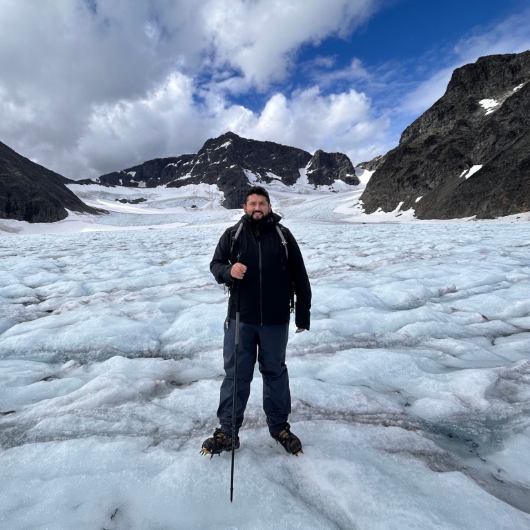
It was a real privilege to experience such a remote Arctic region like Tarfala, I don't think many people get to experience that in their lives so I felt very lucky. To be living in such close proximity to a glacier was a very cool experience. But what was even more interesting was when we walked onto the glacier. We saw how mass balance measurements were conducted on Storglaciären, which has the longest and in detail mass balance record in the world. We therefore saw how much the glacier has melted since 1946, and sadly you could not help but question the glacier's existence by the end of the century.
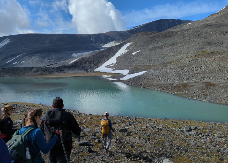
On day 2, with the weather still grey, rainy and windy, station manager Johanna Dahlqvist guided us further north towards the glacial lake Darfáljávri where Kebnepakte glacier has been calving as recently as a few decades ago. Johanna, who is also a certified mountain leader and member of the mountain rescue patrol, took the group around the valley to points of interest, such as the lookout points where many of the historical glacier photographs have been taken more than 130 years ago, and the hydrological discharge measurement point that tracks the outflow of Lillsjön, just a few hundred meters from TRS.
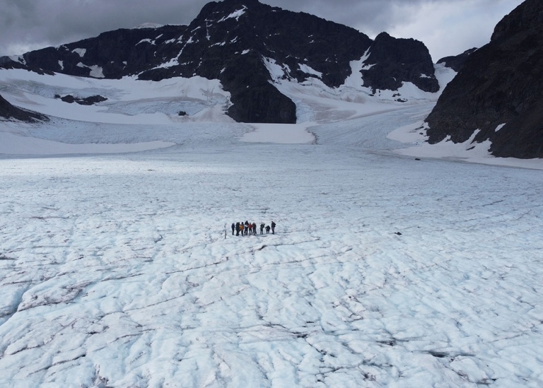
Walking on ice and meeting glaciers
Day three met us with clear skies and bright sunlight, and the station management made the assessment that it was safe to go on the ice in the ablation area of Storglaciären. Johanna, Maja and field assistant Florian gracefully guided us up the moraine and onto the glacier, where we could observe the measurement equipment necessary for calculating the annual mass balance of the glacier, a unique series stretching back more than 70 years. Sadly, we could measure a loss of more than 20 cm of ice after the rains of the previous four days only. Although the measurements were not exhaustive of the entire glacier, they were indicative of the increasing speed at which the ice was being lost.
After three days at the station, we were met with beautiful weather on our hike back towards Nikkaluokta. We are immensely thankful to the department for funding this trip, and to the TRS staff: Nina, Johanna, Maja, Florian, Helene and Erik for giving such a rich, educational and memorable experience.
Last updated: August 23, 2023
Source: Department of Physical Geography