Flying laboratory has landed in Kiruna
An American Hercules airplane visits Kiruna until the beginning of April. The visit is part of a research project to better understand outbreaks of cold air over the Arctic.
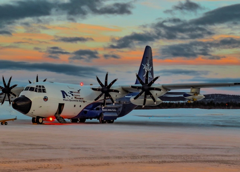
On Sunday, February 25, a large American C-130 Hercules airplane landed at Kiruna Airport. It belongs to the National Center for Atmospheric Research (NCAR)and is part of the research project CAESAR (Cold Air Outbreak Experiment in the Sub-Arctic Region). The aircraft is a flying laboratory equipped with instruments to measure the atmosphere both where it flies and with the help of remote sensing such as radar and lidar, both above and below the aircraft.
Understanding cold air outbreaks
The purpose of the experiment is to understand so-called marine cold air outbreaks, when cold and dry air from the Arctic flows out over warm open water in the Fram Strait or over the Norwegian Sea. The energy exchange it represents, both between the Arctic and the mid-latitudes and that between the cold air and the warm water, is important to the climate system in the north.
“The clouds that form over the water, that sometimes forms characteristic patterns that can be seen from satellite, are of particular importance and during special conditions may evolve to form so-called Polar Lows; intensive storms that can create chaos and destruction,” says Michael Tjernström, professor of meteorology at Stockholm University and researcher within CAESAR.
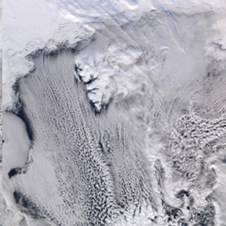
On the left in the satellite image you can see the pack ice in the north, Greenland on the left and Svalbard on the right. From the ice edge between Svalbard and Greenland, it looks like "cloud streets" that "flow" south. As they get further south, these gradually change structure to a more random "knotty" pattern.

Photo: Rickard Kilström
“This is the transformation we are interested in. There are almost no clouds over the ice; these are formed when the dry air comes out over warm sea water. At first the cloudy layer is thin and the clouds form like streaks. As it gets deeper, the wind decreases and it becomes more like bubbles from the clouds,” says Michael Tjernström.
In the far south (at the bottom of the image) Norway stands up and in the lower left corner there is also a weather system with high clouds like a "screen" slowly moving north.
The aircraft is based in Arena Arctica, a special hangar at Kiruna Airport to house, among other things, research aircraft, and flies from there up to the Arctic. Flights were carried out on both Wednesday and Thursday and another flight is scheduled for Saturday.
About 60 researchers are participating in the experiment, which runs until the beginning of April, among them Michael Tjernström, Gunilla Svensson and Anna Lewinschal at the Department of Meteorology, Stockholm University.
Read more about the CAESAR project
Last updated: March 1, 2024
Source: Communications Office