MATS Instrument
The MATS satellite is the first satellite based on the InnoSat platform and will also serve as a pilot mission in an intended programme of small, low-cost research satellites funded by the Swedish National Space Board (SNSB).
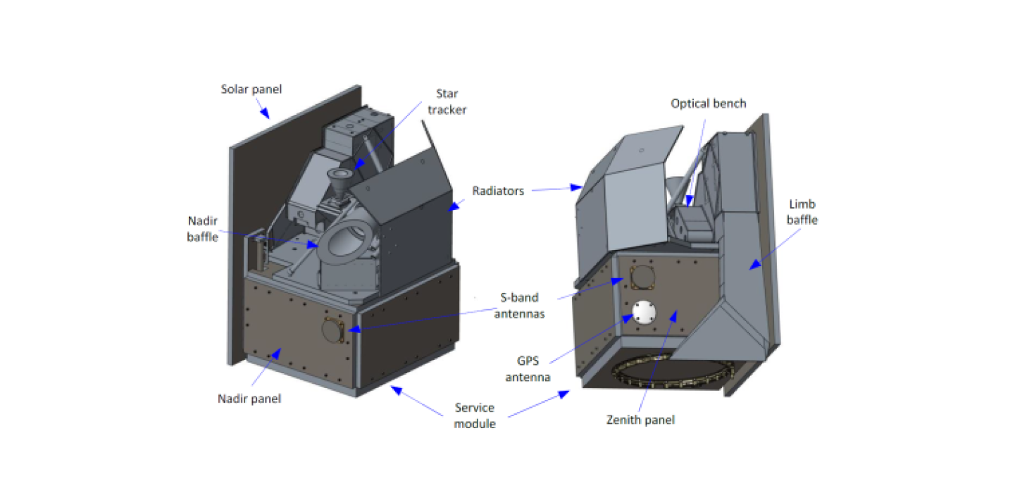
The 50 kg micro satellite was launched in November 2022 as an auxiliary payload into a 560 km sun-synchronous orbit with 21.00 local ascending time (LTAN). There are two science instruments on board: the limb imager and the nadir imager.
In order to capture 3D wave structures in the MLT, MATS is designed to measure two phenomena occurring in the MLT region: Noctilucent clouds and atmospheric airglow from the Oxygen A-Band.
This will be achieved by imaging the limb of the atmosphere at six different wavelengths; two in UV (between 270-300 nm) and four in IR (760-780 nm). The two UV channels will give information on small scale structures using solar light scattered of NLCs, while the IR channels provide larger scale structures, as well as atmospheric temperatures by measuring the emission from photochemically excited oxygen molecules.
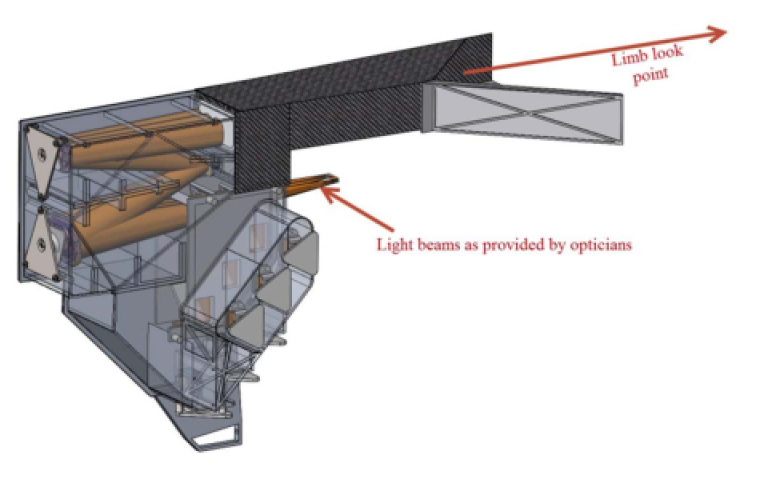
To perform the limb imaging, an off-axis 3 mirror telescope based on free-form mirrors is used. The limb of the atmosphere is imaged onto the 6 CCD channels, where wavelength separation is achieved using a combination of dichroic beam splitters, and narrowband filters.
The image detection is based on advanced CCD sensors with readout electronics that allows for flexible pixel binning and image processing. Telescope optics and interior instrument setup are carefully designed to suppress stray light effects. Of particular importance is the layout of the limb baffle system that is optimized by making use of the entire available length of the InnoSat platform.
In addition to the limb imager, a nadir imager takes pictures of atmospheric band emissions from below the satellite. This provides complementary information on smaller spatial scales, albeit restricted to a single spectral channel.
The nadir instrument is basically a wide angle camera. Data are taken one row at a time, covering a horizontal distance of about 300 km swath width. In contrast to the limb instrument, simpler lens optics is used to image nadir structures on a CCD sensor.
Last updated: November 4, 2022
Source: MISU