Christian StranneAssociate professor of Marine geophysical mapping and modelling
About me
Christian Stranne received his PhD (Nov 2012) in Physical Oceanography from the University of Gothenburg, where he studied large-scale Arctic sea ice dynamics and coupled ocean-sea ice-atmosphere interactions. He has held a two-year postdoc position at the Department of Geological Sciences (IGV), Stockholm University, focusing on methane hydrate dynamics and numerical modelling of multiphase flow in hydrate-bearing marine sediments. Christian became a Swedish Research Council Postdoctoral Fellow in 2015 (three years) during which he shared his time between IGV and the Center for Coastal and Ocean Mapping at the University of New Hampshire, USA. He has since expanded his research to include geophysical mapping with acoustic methods, and in 2017 he received a four-year grant from the Swedish Research Council (co-applicant), for a project on acoustic detection of internal waves in the ocean. Christian became an Assistant Professor in August 2018 and in November the same year he received a four-year grant from the Swedish Research Council for a project on large-scale climate warming-induced seafloor release of methane gas. Christian was promoted to Associate Professor in 2022 and received a four-year grant from the Swedish Research Council the same year, entitled The fate of climate change-induced methane formation in the sediment-ocean-atmosphere system.
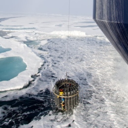
Christian’s field work experience includes five major icebreaker expeditions to Antarctica and the Arctic Ocean, as well as several cruises with smaller vessels in Sweden, Finland and in Chile. His field work expertise lies within acoustic mapping, CTD and LADCP operations, and mooring deployments/recoveries.
Research projects


. Anaerobic oxidation has a minor effect on mitigating seafloor methane emissions from gas hydrate dissociation. Communications Earth & Environment, 3(1), 1–10. https://doi.org/10.1038/s43247-022-00490-x")
Publications
A selection from Stockholm University publication database
-
Potential links between Baltic Sea submarine terraces and groundwater seeping
2020. Martin Jakobsson (et al.). Earth Surface Dynamics 8 (1), 1-15
ArticleRead more about Potential links between Baltic Sea submarine terraces and groundwater seepingSubmarine groundwater discharge (SGD) influences ocean chemistry, circulation, and the spreading of nutrients and pollutants; it also shapes sea floor morphology. In the Baltic Sea, SGD was linked to the development of terraces and semicircular depressions mapped in an area of the southern Stockholm archipelago, Sweden, in the 1990s. We mapped additional parts of the Stockholm archipelago, areas in Blekinge, southern Sweden, and southern Finland using high-resolution multibeam sonars and sub-bottom profilers to investigate if the sea floor morphological features discovered in the 1990s are widespread and to further address the hypothesis linking their formation to SGD. Sediment coring and sea floor photography conducted with a remotely operated vehicle (ROV) and divers add additional information to the geophysical mapping results. We find that terraces, with general bathymetric expressions of about 1 m and lateral extents of sometimes > 100 m, are widespread in the surveyed areas of the Baltic Sea and are consistently formed in glacial clay. Semicircular depressions, however, are only found in a limited part of a surveyed area east of the island of Asko, southern Stockholm archipelago. While submarine terraces can be produced by several processes, we interpret our results to be in support of the basic hypothesis of terrace formation initially proposed in the 1990s; i.e. groundwater flows through siltier, more permeable layers in glacial clay to discharge at the sea floor, leading to the formation of a sharp terrace when the clay layers above seepage zones are undermined enough to collapse. By linking the terraces to a specific geologic setting, our study further refines the formation hypothesis and thereby forms the foundation for a future assessment of SGD in the Baltic Sea that may use marine geological mapping as a starting point. We propose that SGD through the submarine sea floor terraces is plausible and could be intermittent and linked to periods of higher groundwater levels, implying that to quantify the contribution of freshwater to the Baltic Sea through this potential mechanism, more complex hydrogeological studies are required.
-
Low Abundance of Methanotrophs in Sediments of Shallow Boreal Coastal Zones With High Water Methane Concentrations
2020. Elias Broman (et al.). Frontiers in Microbiology 11
ArticleRead more about Low Abundance of Methanotrophs in Sediments of Shallow Boreal Coastal Zones With High Water Methane ConcentrationsCoastal zones are transitional areas between land and sea where large amounts of organic and inorganic carbon compounds are recycled by microbes. Especially shallow zones near land have been shown to be the main source for oceanic methane (CH4) emissions. Water depth has been predicted as the best explanatory variable, which is related to CH4 ebullition, but exactly how sediment methanotrophs mediates these emissions along water depth is unknown. Here, we investigated the relative abundance and RNA transcripts attributed to methane oxidation proteins of aerobic methanotrophs in the sediment of shallow coastal zones with high CH4 concentrations within a depth gradient from 10–45 m. Field sampling consisted of collecting sediment (top 0–2 cm layer) from eight stations along this depth gradient in the coastal Baltic Sea. The relative abundance and RNA transcripts attributed to the CH4 oxidizing protein (pMMO; particulate methane monooxygenase) of the dominant methanotroph Methylococcales was significantly higher in deeper costal offshore areas (36–45 m water depth) compared to adjacent shallow zones (10–28 m). This was in accordance with the shallow zones having higher CH4 concentrations in the surface water, as well as more CH4 seeps from the sediment. Furthermore, our findings indicate that the low prevalence of Methylococcales and RNA transcripts attributed to pMMO was restrained to the euphotic zone (indicated by Photosynthetically active radiation (PAR) data, photosynthesis proteins, and 18S rRNA data of benthic diatoms). This was also indicated by a positive relationship between water depth and the relative abundance of Methylococcales and pMMO. How these processes are affected by light availability requires further studies. CH4 ebullition potentially bypasses aerobic methanotrophs in shallow coastal areas, reducing CH4 availability and limiting their growth. Such mechanism could help explain their reduced relative abundance and related RNA transcripts for pMMO. These findings can partly explain the difference in CH4 concentrations between shallow and deep coastal areas, and the relationship between CH4 concentrations and water depth.
-
Glacial sedimentation, fluxes and erosion rates associated with ice retreat in Petermann Fjord and Nares Strait, north-west Greenland
2020. Kelly A. Hogan (et al.). The Cryosphere 14 (1), 261-286
ArticleRead more about Glacial sedimentation, fluxes and erosion rates associated with ice retreat in Petermann Fjord and Nares Strait, north-west GreenlandPetermann Fjord is a deep ( > 1000 m) fjord that incises the coastline of north-west Greenland and was carved by an expanded Petermann Glacier, one of the six largest outlet glaciers draining the modern Greenland Ice Sheet (GrIS). Between 5 and 70 m of unconsolidated glacigenic material infills in the fjord and adjacent Nares Strait, deposited as the Petermann and Nares Strait ice streams retreated through the area after the Last Glacial Maximum. We have investigated the deglacial deposits using seismic stratigraphic techniques and have correlated our results with high-resolution bathymetric data and core lithofacies. We identify six seismoacoustic facies in more than 3500 line kilometres of subbottom and seismic-reflection profiles throughout the fjord, Hall Basin and Kennedy Channel. Seismo-acoustic facies relate to bedrock or till surfaces (Facies I), subglacial deposition (Facies II), deposition from meltwater plumes and icebergs in quiescent glacimarine conditions (Facies III, IV), deposition at grounded ice margins during stillstands in retreat (grounding-zone wedges; Facies V) and the redeposition of material downslope (Facies IV). These sediment units represent the total volume of glacial sediment delivered to the mapped marine environment during retreat. We calculate a glacial sediment flux for the former Petermann ice stream as 1080-1420 m(3) a(-1) per metre of ice stream width and an average deglacial erosion rate for the basin of 0.29-0.34 mm a(-1). Our deglacial erosion rates are consistent with results from Antarctic Peninsula fjord systems but are several times lower than values for other modern GrIS catchments. This difference is attributed to fact that large volumes of surface water do not access the bed in the Petermann system, and we conclude that glacial erosion is limited to areas overridden by streaming ice in this large outlet glacier setting. Erosion rates are also presented for two phases of ice retreat and confirm that there is significant variation in rates over a glacial-deglacial transition. Our new glacial sediment fluxes and erosion rates show that the Petermann ice stream was approximately as efficient as the palaeo-Jakobshavn Isbra at eroding, transporting and delivering sediment to its margin during early deglaciation.
-
Can anaerobic oxidation of methane prevent seafloor gas escape in a warming climate?
2019. Christian Stranne (et al.). Solid Earth 10 (5), 1541-1554
ArticleRead more about Can anaerobic oxidation of methane prevent seafloor gas escape in a warming climate?Assessments of future climate-warming-induced seafloor methane (CH4) release rarely include anaerobic oxidation of methane (AOM) within the sediments. Considering that more than 90 % of the CH4 produced in ocean sediments today is consumed by AOM, this may result in substantial overestimations of future seafloor CH4 release. Here, we integrate a fully coupled AOM module with a numerical hydrate model to investigate under what conditions rapid release of CH4 can bypass AOM and result in significant fluxes to the ocean and atmosphere. We run a number of different model simulations for different permeabilities and maximum AOM rates. In all simulations, a future climate warming scenario is simulated by imposing a linear seafloor temperature increase of 3 degrees C over the first 100 years. The results presented in this study should be seen as a first step towards understanding AOM dynamics in relation to climate change and hydrate dissociation. Although the model is somewhat poorly constrained, our results indicate that vertical CH4 migration through hydraulic fractures can result in low AOM efficiencies. Fracture flow is the predicted mode of methane transport under warming-induced dissociation of hydrates on upper continental slopes. Therefore, in a future climate warming scenario, AOM might not significantly reduce methane release from marine sediments.
-
Observations and Modeling of a Hydrothermal Plume in Yellowstone Lake
2019. Robert A. Sohn (et al.). Geophysical Research Letters 46 (12), 6435-6442
ArticleRead more about Observations and Modeling of a Hydrothermal Plume in Yellowstone LakeAcoustic Doppler current profiler and conductivity-temperature-depth data acquired in Yellowstone Lake reveal the presence of a buoyant plume above the Deep Hole hydrothermal system, located southeast of Stevenson Island. Distributed venting in the similar to 200 x 200-m hydrothermal field creates a plume with vertical velocities of similar to 10 cm/s in the mid-water column. Salinity profiles indicate that during the period of strong summer stratification the plume rises to a neutral buoyancy horizon at similar to 45-m depth, corresponding to a similar to 70-m rise height, where it generates an anomaly of similar to 5% (-0.0014 psu) relative to background lake water. We simulate the plume with a numerical model and find that a heat flux of 28 MW reproduces the salinity and vertical velocity observations, corresponding to a mass flux of 1.4 x 10(3) kg/s. When observational uncertainties are considered, the heat flux could range between 20 to 50 MW.
-
Acoustic mapping of mixed layer depth
2018. Christian Stranne (et al.). Ocean Science 14 (3), 503-514
ArticleRead more about Acoustic mapping of mixed layer depthThe ocean surface mixed layer is a nearly universal feature of the world oceans. Variations in the depth of the mixed layer (MLD) influences the exchange of heat, fresh water (through evaporation), and gases between the atmosphere and the ocean and constitutes one of the major factors controlling ocean primary production as it affects the vertical distribution of biological and chemical components in near-surface waters. Direct observations of the MLD are traditionally made by means of conductivity, temperature, and depth (CTD) casts. However, CTD instrument deployment limits the observation of temporal and spatial variability in the MLD. Here, we present an alternative method in which acoustic mapping of the MLD is done remotely by means of commercially available ship-mounted echo sounders. The method is shown to be highly accurate when the MLD is well defined and biological scattering does not dominate the acoustic returns. These prerequisites are often met in the open ocean and it is shown that the method is successful in 95% of data collected in the central Arctic Ocean. The primary advantages of acoustically mapping the MLD over CTD measurements are (1) considerably higher temporal and horizontal resolutions and (2) potentially larger spatial coverage.
-
The Holocene retreat dynamics and stability of Petermann Glacier in northwest Greenland
2018. Martin Jakobsson (et al.). Nature Communications 9
ArticleRead more about The Holocene retreat dynamics and stability of Petermann Glacier in northwest GreenlandSubmarine glacial landforms in fjords are imprints of the dynamic behaviour of marine-terminating glaciers and are informative about their most recent retreat phase. Here we use detailed multibeam bathymetry to map glacial landforms in Petermann Fjord and Nares Strait, northwestern Greenland. A large grounding-zone wedge (GZW) demonstrates that Petermann Glacier stabilised at the fjord mouth for a considerable time, likely buttressed by an ice shelf. This stability was followed by successive backstepping of the ice margin down the GZW's retrograde backslope forming small retreat ridges to 680 m current depth (similar to 730-800 m palaeodepth). Iceberg ploughmarks occurring somewhat deeper show that thick, grounded ice persisted to these water depths before final breakup occurred. The palaeodepth limit of the recessional moraines is consistent with final collapse driven by marine ice cliff instability (MICI) with retreat to the next stable position located underneath the present Petermann ice tongue, where the seafloor is unmapped.
-
Acoustic Mapping of Thermohaline Staircases in the Arctic Ocean
2017. Christian Stranne (et al.). Scientific Reports 7
ArticleRead more about Acoustic Mapping of Thermohaline Staircases in the Arctic OceanAlthough there is enough heat contained in inflowing warm Atlantic Ocean water to melt all Arctic sea ice within a few years, a cold halocline limits upward heat transport from the Atlantic water. The amount of heat that penetrates the halocline to reach the sea ice is not well known, but vertical heat transport through the halocline layer can significantly increase in the presence of double diffusive convection. Such convection can occur when salinity and temperature gradients share the same sign, often resulting in the formation of thermohaline staircases. Staircase structures in the Arctic Ocean have been previously identified and the associated double diffusive convection has been suggested to influence the Arctic Ocean in general and the fate of the Arctic sea ice cover in particular. A central challenge to understanding the role of double diffusive convection in vertical heat transport is one of observation. Here, we use broadband echo sounders to characterize Arctic thermohaline staircases at their full vertical and horizontal resolution over large spatial areas (100 s of kms). In doing so, we offer new insight into the mechanism of thermohaline staircase evolution and scale, and hence fluxes, with implications for understanding ocean mixing processes and ocean-sea ice interactions.
-
Modeling fracture propagation and seafloor gas release during seafloor warming-induced hydrate dissociation
2017. Christian Stranne, Matthew O'Regan, Martin Jakobsson. Geophysical Research Letters 44 (16), 8510-8519
ArticleRead more about Modeling fracture propagation and seafloor gas release during seafloor warming-induced hydrate dissociationThe stability of marine methane hydrates and the potential release of methane gas to the ocean and atmosphere have received considerable attention in the past decade. Sophisticated hydraulic-thermodynamic models are increasingly being applied to investigate the dynamics of bottom water warming, hydrate dissociation, and gas escape from the seafloor. However, these models often lack geomechanical coupling and neglect how overpressure development and fracture propagation affect the timing, rate, and magnitude of methane escape. In this study we integrate a geomechanical coupling into the widely used TOUGH+Hydrate model. It is shown that such coupling is crucial in sediments with permeability 10(-16)m(2), as fracture formation dramatically affects rates of dissociation and seafloor gas release. The geomechanical coupling also results in highly nonlinear seafloor gas release, which presents an additional mechanism for explaining the widely observed episodic nature of gas flares from seafloor sediments in a variety of tectonic and oceanographic settings.
-
Conductive heat flow and nonlinear geothermal gradients in marine sediment—observations from Ocean Drilling Program boreholes
2016. Christian Stranne, Matt O`Regan. Geo-Marine Letters 36 (1), 25-33
ArticleRead more about Conductive heat flow and nonlinear geothermal gradients in marine sediment—observations from Ocean Drilling Program boreholesA basic premise in marine heat flow studies is that the temperature gradient varies with depth as a function of the bulk thermal conductivity of the sediments. As sediments become more deeply buried, compaction reduces the porosity and causes an increase in the bulk thermal conductivity. Therefore, while the heat flow may remain constant with depth, the thermal gradient is not necessarily linear. However, it has been argued that measurements showing increased sediment thermal conductivity with burial depth may be caused by a horizontal measurement bias generated by increasing anisotropy in sediments during consolidation. This study reanalyses a synthesis of Ocean Drilling Program data from 186 boreholes, and investigates the occurrence of nonlinear geothermal gradients in marine sediments. The aim is to identify whether observed downhole changes in thermal conductivity influence the measured temperature gradient, and to investigate potential errors in the prediction of in-situ temperatures derived from the extrapolation of near-surface thermal gradients. The results indicate that the measured thermal conductivity does influence the geothermal gradient. Furthermore, comparisons between shallow measurements (<10 m) from surface heat flow surveys and the deeply constrained temperature data from 98 ODP boreholes indicate that the shallow gradients are consistently higher by on average 19 °C km–1. This is consistent with higher porosity and generally lower thermal conductivity in near-seafloor sediments, and highlights the need to develop robust porosity–thermal conductivity models to accurately predict temperatures at depth from shallow heat flow surveys.
-
Dynamic simulations of potential methane release from East Siberian continental slope sediments
2016. Christian Stranne (et al.). Geochemistry Geophysics Geosystems 17 (3), 872-886
ArticleRead more about Dynamic simulations of potential methane release from East Siberian continental slope sedimentsSediments deposited along continental margins of the Arctic Ocean presumably host large amounts of methane (CH4) in gas hydrates. Here we apply numerical simulations to assess the potential of gas hydrate dissociation and methane release from the East Siberian slope over the next 100 years. Simulations are based on a hypothesized bottom water warming of 3 degrees C, and an assumed starting distribution of gas hydrate. The simulation results show that gas hydrate dissociation in these sediments is relatively slow, and that CH4 fluxes toward the seafloor are limited by low sediment permeability. The latter is true even when sediment fractures are permitted to form in response to overpressure in pore space. With an initial gas hydrate distribution dictated by present-day pressure and temperature conditions, nominally 0.35 Gt of CH4 are released from the East Siberian slope during the first 100 years of the simulation. However, this CH4 discharge becomes significantly smaller (approximate to 0.05 Gt) if glacial sea level changes in the Arctic Ocean are considered. This is because a lower sea level during the last glacial maximum (LGM) must result in depleted gas hydrate abundance within the most sensitive region of the modern gas hydrate stability zone. Even if all released CH4 reached the atmosphere, the amount coming from East Siberian slopes would be trivial compared to present-day atmospheric CH4 inputs from other sources.
-
Overestimating climate warming-induced methane gas escape from the seafloor by neglecting multiphase flow dynamics
2016. Christian Stranne, Matthew O'Regan, Martin Jakobsson. Geophysical Research Letters 43 (16), 8703-8712
ArticleRead more about Overestimating climate warming-induced methane gas escape from the seafloor by neglecting multiphase flow dynamicsContinental margins host large quantities of methane stored partly as hydrates in sediments. Release of methane through hydrate dissociation is implicated as a possible feedback mechanism to climate change. Large-scale estimates of future warming-induced methane release are commonly based on a hydrate stability approach that omits dynamic processes. Here we use the multiphase flow model TOUGH+hydrate (T+H) to quantitatively investigate how dynamic processes affect dissociation rates and methane release. The simulations involve shallow, 20-100m thick hydrate deposits, forced by a bottom water temperature increase of 0.03 degrees Cyr(-1) over 100years. We show that on a centennial time scale, the hydrate stability approach can overestimate gas escape quantities by orders of magnitude. Our results indicate a time lag of>40years between the onset of warming and gas escape, meaning that recent climate warming may soon be manifested as widespread gas seepages along the world's continental margins.
-
Evidence for an ice shelf covering the central Arctic Ocean during the penultimate glaciation
2016. Martin Jakobsson (et al.). Nature Communications 7
ArticleRead more about Evidence for an ice shelf covering the central Arctic Ocean during the penultimate glaciationThe hypothesis of a km-thick ice shelf covering the entire Arctic Ocean during peak glacial conditions was proposed nearly half a century ago. Floating ice shelves preserve few direct traces after their disappearance, making reconstructions difficult. Seafloor imprints of ice shelves should, however, exist where ice grounded along their flow paths. Here we present new evidence of ice-shelf groundings on bathymetric highs in the central Arctic Ocean, resurrecting the concept of an ice shelf extending over the entire central Arctic Ocean during at least one previous ice age. New and previously mapped glacial landforms together reveal flow of a spatially coherent, in some regions41-km thick, central Arctic Ocean ice shelf dated to marine isotope stage 6 (similar to 140 ka). Bathymetric highs were likely critical in the ice-shelf development by acting as pinning points where stabilizing ice rises formed, thereby providing sufficient back stress to allow ice shelf thickening.
Show all publications by Christian Stranne at Stockholm University