The databases cover coin finds among other things. With the help of the
databases, it is possible to make distribution maps covering coin finds
from different periods or different areas. A number of maps of this kind
will be available one by one on this website.
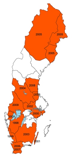
Analysis of how the coin circulation, mainly based on the hoards,
changed over time from A.D. to the end of the 18th c. have been
published in our annual report. To date they cover 11 provinces. The map
below shows the provinces covered so far and the year of the annual
report where the analysis has been published.
Open access pdf Annual reports (in Swedish)