Research project Mapping Eelgrass Meadows in Swedish Coastal Areas: Earth Observation supporting Blue Carbon Research
Seagrass meadows and seaweeds are vital for marine life, carbon storage, and shoreline protection, but they are declining due to human impacts and climate change. To safeguard these ecosystems, we need better ways to track where they grow and how they change.
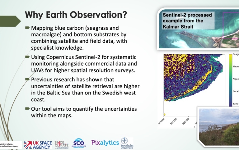
This project uses satellites to map underwater vegetation along the Swedish west coast and Kalmar Sound. Sentinel-2 provides detailed images that detect seagrass and seaweed in shallow waters, while Sentinel-3 measures water clarity and light, which determine where plants can thrive. Field and lab studies help confirm and improve the satellite results by linking reflectance signals to submerged vegetation.
The project will create an open, web-based tool showing the distribution of macroalgae and eelgrass. This resource will guide coastal managers and policymakers in protecting seagrass meadows and identifying areas suitable for restoration, helping to halt biodiversity loss and build healthier coastal ecosystems.
The project is funded from the 15 December 2024 to 1 February 2026 by the Swedish National Space Agency (SNSA).
In March 2023, the project was endorsed by the Space For Climate Observation (SCO) programme.
Project members
Project managers
Susanne Kratzer
Forskare, Docent

Members
Dr. Samantha Lavender
Project partner