Research project iQ2300: East Antarctic Sea level rise contribution in 2300
iQ2300 aims at a multi-disciplinary approach to the terrestrial and marine responses of the Queen Maud Land margin, one of the most vulnerable parts of the East Antarctic Ice Sheet, across geological (>10³ yr), historical (10² yr), and recent (<10¹ yr) timescales.

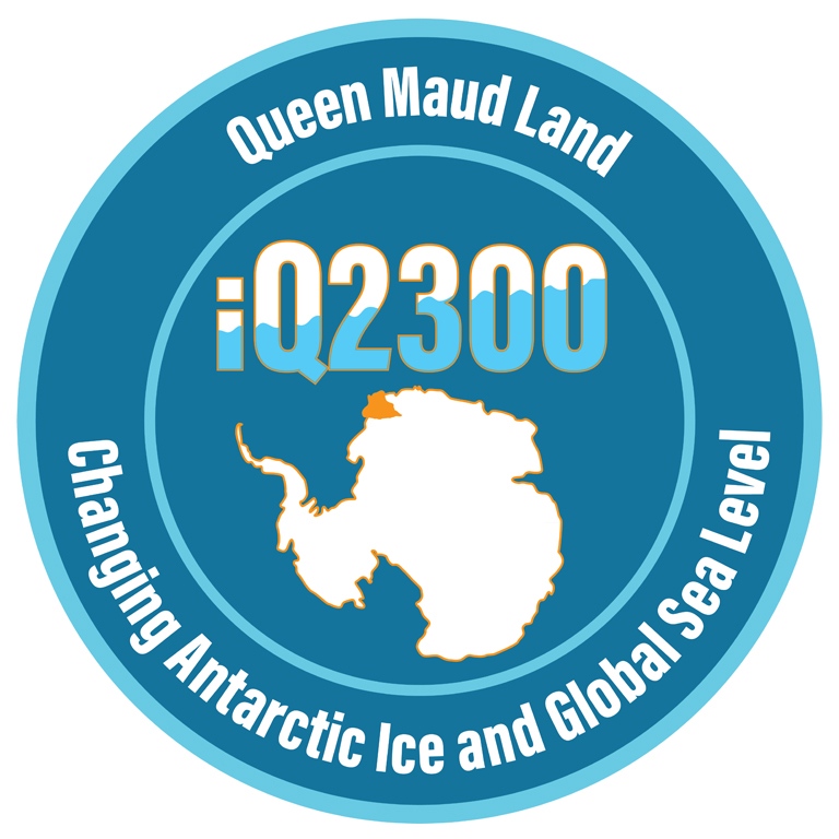
A project about East Antarctic sea-level rise
iQ2300 aims at a multi-disciplinary approach to the terrestrial and marine responses of the Queen Maud Land margin (Fig. 1), one of the most vulnerable parts of the East Antarctic Ice Sheet, across geological (>10³ yr), historical (10² yr), and recent (<10¹ yr) timescales.
Mass loss from the Antarctic ice sheet is the major uncertainty in projections of future sea-level rise (SLR). Specific regions in West Antarctica are already losing mass, but there is considerable uncertainty in future mass loss from Antarctica as a whole. In particular, it is unclear whether East Antarctica will continue to be as stable as present. Field data that address critical areas are needed to reduce model uncertainty, and models should integrate the regional field evidence into a global picture of ice sheet evolution and regional sea-level variations.
Our iQ2300 consortium addresses scientific questions focused on predicting the future evolution of ice shelves, understanding the melt- and freeze processes occurring in the ice-ocean boundary layer, and how they relate to the steering of intruding water masses caused by local bathymetry and/or ice shelf basal topography, and ice catchment dynamics.
Project description
Scientific Goals
This project aims to reduce uncertainty in projections of future SLR for 2300 by using data collected from field expeditions and remote sensing on the Queen Maud Land margin (QMM) to address key knowledge gaps that limit our ability to model Antarctic ice sheet responses to future climate.
These knowledge gaps include surface mass balance patterns, ice-shelf thickness and basal topography, continental shelf bathymetry, and boundary layer properties in the sub-shelf cavity near the grounding line.
The study of the Riiser-Larsen Ice Shelf (R-LIS), which is the largest ice shelf of QMM, aims to identify the mechanisms which may cause its destabilisation and thereby serve as a tipping point in East Antarctic Ice Sheet (EAIS) evolution using a joint approach of terrestrial, marine and modelling perspectives (Fig. 2).
The marine science area
Marine-based activities in iQ2300 will provide crucial information about the current state and dynamics of R-LIS and the underlying ocean and the recent geological behaviour of the grounding line and ice shelf.
Terrestrial science focus
The terrestrial science focus of iQ2300 provides information about the current state of the R-LIS catchment cryosphere, including structural stability, and will be determined for two key regions: the meltwater-affected regions of R-LIS and the onset area of ice streaming.
Modelling science perspective
From a modelling science perspective, uncertainties in projections of ice mass variations in Antarctica are dominated by poorly constrained conditions at the interfaces between the ice and the surrounding systems: the atmosphere, the ocean, and the solid Earth.
Duration and times
The field seasons for the thematic expeditions are planned to start during the Antarctic summer season 2025/2026 and continue until the Antarctic summer season 2029/2030. Each research topic will be designed to cover one or more field seasons during the specified period.
Work packages (WP)
We aim to reduce uncertainty in projections of future SLR for 2300 by using data collected from field expeditions and remote sensing on the Queen Maud Land margin (QMM) to address key knowledge gaps that limit our ability to model Antarctic ice sheet responses to future climate. These knowledge gaps include surface mass balance patterns, ice-shelf thickness and basal topography, continental shelf bathymetry, and boundary layer properties in the sub-shelf cavity near the grounding line. We focus on the Riiser-Larsen Ice Shelf and its catchment (Fig 1).

Map of the Riiser-Larsen Ice Shelf catchment and approximate regions of study for iQ2300 Work Packages; 2-4 offshore, 4-6 on the ice shelf, and 7-11 on the ice sheet above the grounding line. See list below for explanation of the objectives of the different work packages. Figure: Martim Mas e Braga.

All the Research topics
The scientific goals in iQ2300 are presented in WP 1-15 addressing the overall aim with ice sheet, sea-level, climate and Earth system modelling to marine and terrestrial field components that provide data needed to calibrate/validate the models, and ends with societal impact and outreach components. The research will be of use for society at large through outreach and for Swedish coastal communities in particular through integration of more robust sea level rise estimates for 2300 in their adaptation plans (WP13,14).
WP1. The EAIS contribution to global sea-level rise (SLR) in 2300
Using state-of-the-art variable-resolution global ice sheet modelling, the WP aims to contribute to new knowledge: A well-constrained ice sheet model based on field-based data (WP2-11) from the R-LIS catchment supports an improved understanding and quantification of the physical processes governing mass change in Antarctica. This knowledge translates into improved global and, through modelling in WP13, to regional estimates of SLR.
PIs Jorge Bernales (DMI), Arjen Stroeven (SU)
WP2. Continental shelf landforms and sediment cores
Contribution to new knowledge: First detailed mapping of continental shelf bathymetry in this sector of East Antarctica. Determine rates of past grounding line retreat and LGM-Holocene ice sheet change (complementary to WP11). Characterize depositional processes and oceanographic conditions across highly varied glaciological and bathymetric settings.
PIs Sarah Greenwood (SU), Benedict Reinardy (KTH)
WP3. Cosmogenic nuclides in offshore sediments
Contribution to new knowledge: Information on Holocene ice sheet fluctuations will be derived from shore normal transects. R-LIS front-parallel transects will capture spatial differences in responses to climate change between sectors with slow basal sliding rates and more rapidly flowing ice streams. PI Bradley Goodfellow (SGU)
WP4. Boundary conditions for the ice shelf system
Boundary conditions are a key unknown currently inhibiting accurate modelling of subshelf melt. These include shelf bathymetry, ice shelf draft, and the pattern of ocean currents. Contribution to new knowledge: A first map of the seabed and the base of key ice shelves in QMM. Estimates of ocean currents and of oceanic heat transport to R-LIS.
PIs Anna Wåhlin (GU), Adam Ulfsbo (GU)
WP5. Monitoring of sub-ice shelf systems
Using gravimetric and seismic measurements and drilling through R-LIS (sea-floor sediments /ice penetrating radar for monitoring) will establish a regional seafloor bathymetry beneath R-LIS (Fig. 2). Contribution to new knowledge: A first regional sub-shelf bathymetry and ocean circulation model for R-LIS. Monitoring of ice shelf-ocean interactions and ice shelf thickness. PIs Ola Fredin (NTNU), Arjen Stroeven (SU)
WP6. Precursor studies of ice shelf break-up
Extensive perennial firn aquifers (PFAs) act as englacial water reservoirs that can have a large impact on the evolution of both the ice shelf and terrestrial ice flow through hydrofracturing. Contribution to new knowledge: Advanced understanding of the distribution and dynamics of PFAs, and improved understanding of the future evolution of PFAs and their potential role in ice shelf break-up and upstream flow, which is critical for the ice sheet model. PIs Ward van Pelt (UU), Katrin Lindbäck (UU)
WP7. Glaciology of ice stream onset area
Most ice originates from large upstream onset areas and, controlled by subglacial topography and friction, flows into discrete fast-flowing ice streams (Fig. 1). Contribution to new knowledge: Through inversion procedures, surface conditions can be used to derive basal topography over larger areas that lack direct measurements. The data collected is assimilated into ice-flow models (WP1,12) to constrain the velocity field and to investigate the temporal evolution of changes in the onset area in response to changes downstream and at the ice base. PIs Ward van Pelt (UU), Katrin Lindbäck (UU)
WP8. Surface mass balance
Using continental and regional atmospheric climate modelling with the state-of-the-art Harmonie-Climate (HCLIM) regional climate model and constrained by field-derived model targets consisting of spatial and temporal variations of SMB, contributions to new knowledge are: Projections of surface temperature and precipitation to 2300. SMB is needed for satellite radar data calibration and validation (WP9), and for studies of dynamic glaciology, especially the firn modelling component (WP6), and towards environmental monitoring (e.g., occurrences of microplastics and Light Absorbing Particles, including black carbon). PIs Gunhild Rosqvist (SU), Ruth Mottram (DMI)
WP9. Earth observation (Remote Sensing)
Contribute to new knowledge: Maps of surface motion and ice fluxes. Observations will determine surface elevation change at seasonal and inter-annual time scales, penetration bias-corrected surface velocities in three dimensions, evidence for ice shelf flexure, and changes in R-LIS pinning and grounding zones. Global Navigation Satellite System data will be collected (WP10) to validate satellite products. PIs Ian Brown (SU), Celia Baumhoer (DLR)
WP10. Earth observation (Geodetic)
Based on existing geodetic infrastructure and time series from QMM, permitting detection of vertical crustal movements, and using permanent reflectors for SAR technique (WP9), contributions to new knowledge are: Information about the response of the crust to past and present-day ice load; a crucial component in calibrating the coupled ice sheet–global isostatic adjustment model. Geodetic observations are used as ground control points and validation for other studies (e.g. WP7,9).
PIs Maaria Nordman (AaltoU), Arjen Stroeven (SU)
WP11. Reconstructing paleo-ice surface elevations
To reconstruct EAIS configurations smaller-than-today and evaluate whether observed thickening in DML represents a short-term or long-term trend, by retrieving shallow bedrock cores from beneath the ice sheet. We will analyse these cores using cosmogenic nuclide exposure and luminescence techniques to reveal whether the ice-sheet surface was lower-than-today within recent millennia and/or during past global warm periods such as the last interglacial. The subglacial transects will extend transects of samples collected above the ice surface as part of MAGIC-DML in 2023/ 24, to capture a more complete record of past ice-surface fluctuations. Contribution to new knowledge: Constraints on EAIS paleo-surface elevations as targets for model calibration. PIs Jane Lund Andersen (ViaU), Arjen Stroeven (SU)
WP12. Observational era analogues of future change
This WP advances understanding of QMM using modern analogues in rapidly changing sectors of the Antarctic Peninsula (Larsen ice shelves A-D) and West Antarctica (Amundsen Sea sector) where detailed observations exist for recent decades and are being extended by Chilean and Swedish teams. Both sectors have experienced significant acceleration of ice streams in response to ice shelf collapse or grounding line retreat. The iQ2300 will use these regions to test whether our numerical models capture complex processes driving documented increases in ice discharge and to identify deficiencies in earlier observational and analytical techniques. Contribution to new knowledge: Direct translation of observational records from the Antarctic Peninsula and West Antarctica to high-confidence projections of the future EAIS response to climate change.
PIs Irina Rogozhina (CEAZA), Anna Wåhlin (GU)
WP13. Implications for coastal Swedish communities
Using a knowledge co-creation strategy that engages Swedish coastal communities (see WP14), and the FACTS regional and local SLR model prediction tool, we adress societal uncertainties about future sea level rise. Contribution to new knowledge: translation of changes in Antarctica (WP1) to regional and global mean sea level information and to regional impact assessments for adoption by Swedish stakeholders, including an evaluation of the potential for coastal erosion and flooding.
PIs Roderik van de Wal (UtrechtU), Bradley Goodfellow (SGU)
WP14. Leveraging research for societal relevance and impact
Within this WP, process, location, and results will jointly provide an opportunity to advance understanding and inspire action among decision-makers, the public, and future decision-makers (young people). Contribution to new knowledge: Assess the impact of novel strategies for science dissemination and impact, including a children’s book on SLR, a diary from Antarctica written by a refugee, a documentary presenting both the way science is advanced and SLR implications, and physical and digital installations for museums and schools. PIs Jonathan Harbor (PurdueU), Marit Törnqvist (homepage)
WP15: Earth system modelling and future projections of the Antarctic cryosphere
This WP will use the EC-Earth model to simulate warmer climate states and explore Antarctica's response to increased greenhouse gases and its global climate impact through changes in ice-sheet extent and dynamics and ocean circulation patterns. Expected contributions to new knowledge: provide crucial boundary conditions for ice-sheet modelling (WP1) and regional climate downscaling (WP8) in support of understanding the future trajectory of the Antarctic cryosphere and its significance for global climate. PIs Qiong Zhang (SU), Ilana Wainer (U São Paulo)